The Murim
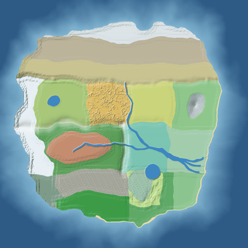
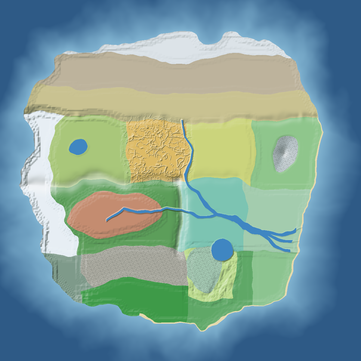
One fixed continent: cold and empty in the north, lush in the south, the sea to the east.
Open the atlas of the Murim
Every zone, capital and site, with coordinates and the teleport command.
The continent
In a new world the overworld is one Murim continent about 10 000 blocks wide, centred on 0, 0, with bays and capes and ocean all around. The west ends in snow peaks, the east in beaches. The layout is the same in every world; only the small details change with the seed.
North is -Z. Crossing from west to east takes about 30 minutes sprinting, or 12 on a horse. You start near 0, 0, on the Loess Plateau.
The ten zones
Coordinates are approximate: zone borders wave over hundreds of blocks.
| Zone | Where | Biomes | Look |
|---|---|---|---|
| Northern wastes | The far north (Z below -2100) | Frozen Steppe, Cold Desert, Frozen Tundra | Snow, stone and drifts; the gravel and sand of the Gobi; drifting snow and white dust. |
| Qinghai | North-west | Qinghai Plateau, Western Snow Peaks | A high plateau around Y 120-150, ending in snow peaks over 200 blocks high in the west; the white-crusted salt lake. |
| Shaanxi | North, west of the yellow river | Loess Plateau | Terracotta ground with a red band, cut by deep ravines. Chang-An's ground. |
| Central plains | North, east of the yellow river | Central Plains | Low, open plains. |
| Shandong | North-east | Shandong Hills, Sacred Mountain | Rolling hills and the sacred mountain, about 217 blocks high, with stone spires and snow on top. |
| Sichuan | South-west | Red Basin, Bamboo Mountains | A red-earth basin ringed by bamboo mountains, ending in deep gorges to the east. |
| Hubei | South centre | Hubei Waterlands, River Delta | Mud, clay, canals and ponds; Wuhan; the great river's delta at the coast. |
| Unnam | Far south-west | Stone Forest, Western Gorges, Unnam Jungle | Thin stone blades rising from the forest, bare gorges and jungle. |
| Honam | Far south | Stone Peaks, Rice Terraces, Subtropical Forest | A forest of tall stone pillars, hills cut into stepped rice paddies, and dense forest. |
| East coast | South-east and the shore | Southeast Coast, beaches, oceans | Beaches and capes on the eastern sea. |
Landmarks
- The north wall: a ridge 20 to 40 blocks high along the northern border, crossed by four passes.
- A mountain chain across the middle of the continent: high and wooded in the west, low hills in the east.
- The yellow river runs south from the north to Wuhan, 30 to 60 blocks wide.
- The great river flows east from the Sichuan basin through the gorges to Wuhan, then 80 to 100 blocks wide to its three-armed delta.
- The great lake in the south (about 380 blocks across in radius) and the Qinghai salt lake high on the plateau.
- The sacred mountain in Shandong, crowned with granite spires and mist.
- The stone peaks of Honam: a forest of stone pillars topped with trees.
- The rice terraces: hills cut into steps of water-filled paddies with young rice, retaining walls and wooded tops.
- The flat grounds of the two capitals, Chang-An (on the loess, near -1300, -700) and Wuhan (at the meeting of the rivers, near 950, 1100).
Ambience
Mist thickens in the damp and high zones (the sacred mountain most of all), snow drifts in the north and on the peaks, white dust blows over the Gobi and the loess, and spores float in the bamboo and the southern forests.